Planning
XSP provides service to Planning professionals and volunteer organizations by offering high-quality Cartographic Production and Geographic Information Systems analysis.
In this example, the percent of street tree canopy over the Rights-of-Way of public conveyances is presented. These types of maps serve to assist City arborists in prioritizing which streets to provide more tree plantings and formulate a tree-planting plan of action.
Visual Impact Analysis
This illustration demonstrates the power of LIDAR data to improve delineation of the Zone of Visual Influence of a multi-turbine wind project about six kilometers to the NNW.
The novel technique of quantifying visual impact as the sum of the angular subtenses (vertical angular measure of the visible portion of a structure) is featured here. This method--pioneered by Xtra-Spatial Production, LLC and coded in python by James Zack--has many advantages over traditional seen/not seen viewshed analysis. By quantifying visual impact using subtenses, the distance between the structure and the observer is accounted for, as well as the portion of the structure that is not occluded from the observer by intervening terrain and/or vegetation.
Visualization and 3D Rendering
This photo-realistic rendering of the main face of Vail Mountain Ski Resort includes native species of trees, chair lifts, cliffs, and mogul fields.
The rendering was used as a proof-of-concept for a company specializing in superimposition of skiers' tracks on a suitable background.
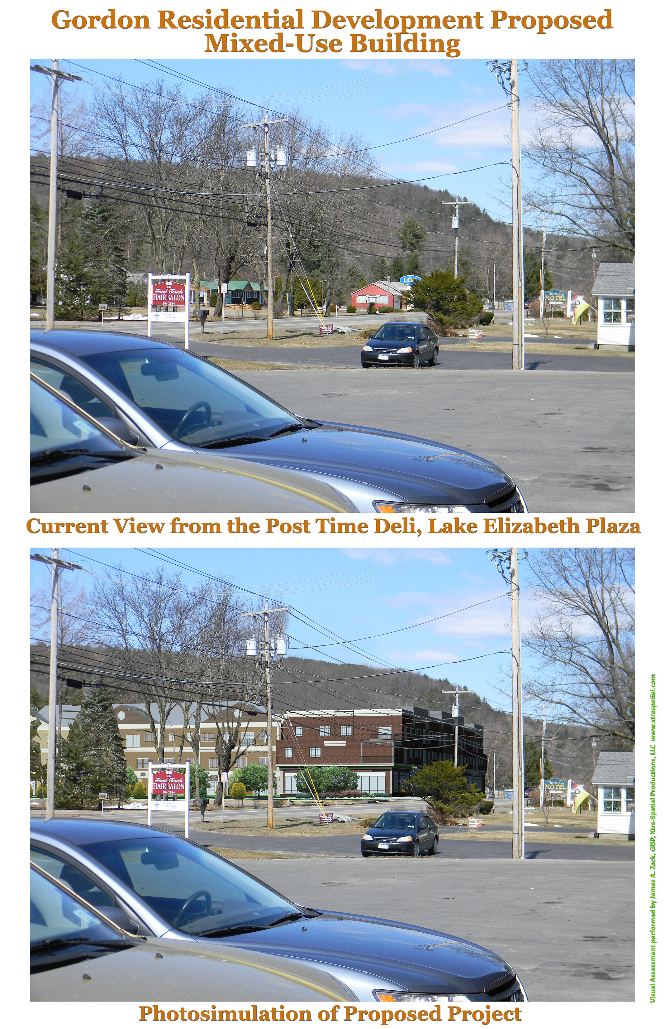
Community Engagement
As part of the planning process, public input must be solicited. This photo-simulation demonstrates the potential visual impact of a large mixed-use structure along Maple Avenue (US Route 9) in Wilton, NY. The size, scope, and context of the proposed structure can be compared to the existing conditions. While typically, planners and developers produce renderings of projects from a point of view that is within the project domain, such renders fail to take into account the gestalt or entirety of the project by omitting views from outside the domain of the project itself. This omission can create a more attractive appearance than if the project was presented with its visual context including foreground and background elements of the scene.
The illustration on the right depicts the proposed project as seen from a viewpoint approximately 300 meters (1000 feet) south of the proposed project site.